Geographic Information System (GIS)

Geographic Information System (GIS)

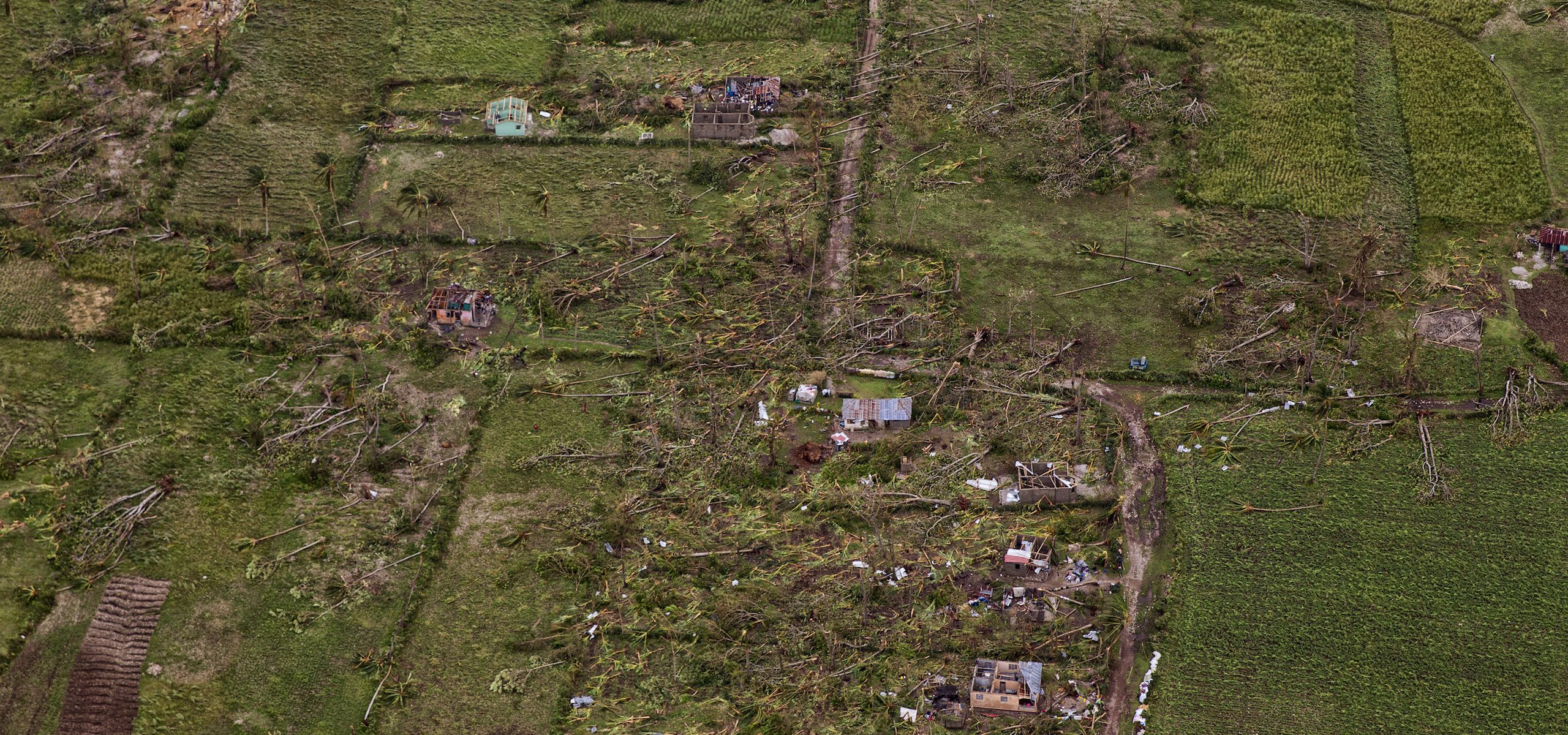
How can geospatial data be used to integrate environmental considerations into humanitarian response

Geographic Information System (GIS)

Back

GIS stands for Geographic (or Geospatial) Information Systems. Geospatial data is data that has a spatial component such as location or geographic coordinates tied to it. Geospatial data is an incredibly powerful resource for disaster response and preparedness and one that is often underutilized by humanitarian practitioners. This data is widely available and most often free and open source. Users can download geospatial data and input it into GIS software for quick analyses or planning purposes, or have the option to view and analyze spatial data through the increasingly common online mapping platforms.

 GIS data can be used in a number of ways:

Geospatial data is also integral for implementing environmental considerations into humanitarian response, as much of environmental data has a spatial component. Data that can be used for environmental considerations includes:

Publicly available GIS data includes layers for, amongst others, administrative boundaries, roads, land cover and use, precipitation, climate, buildings, health facilities, airports and infrastructure.

For example, for settlement planning, a user could add the coordinates of a potential settlement, overlay it with various environmental layers, and use the results to determine if it is an appropriate location. They could also quickly assess multiple site locations and choose the best option. For example, they could see if the proposed settlement intersects with any threats, such as erosion, unstable ground, or flood areas, or can determine if the site is too close in proximity to these or other threats. With GIS, you can measure the actual distance to threats/areas of concern using accurate measuring tools. Elevation datasets can also aid in determining the best location for a site. Other GIS layers such as administrative boundaries, roads, population density, land cover/land use, infrastructure, precipitation, climate, hospitals/health facilities, airports, etc. can all be incredibly helpful for planning. For shelter construction purposes, GIS data can be used to understand what natural resources and building materials are locally available, the level of abundance, and if those resources are threatened and should be conserved. However all of this is dependent on data availability for the region of interest, and data richness can vary greatly from country to country.

GIS data can be vector (feature) data which includes vertices and paths for most commonly points, lines, and polygons, or raster (grid) data which contains a matrix of cells that each contain a value representing information. Standard formats for GIS data include shapefiles (.shp), .kmz/.kml .json, .lyr, .gdb, and .xml files. These formats are widely supported, available for download, and can be input into any GIS software or interface. Standard formats for remotely sensed satellite images includes GeoTIFFs (.tif), .dem, .bil, .hdx and .grid.

The following resources, platforms and softwarre are useful for environmental and humanitarian actors active within a humanitarian setting:

Data

Software

Online platforms

Resources

Tool

Wikimapia

This resource provides multi-layered satellite imagery with open-access data including roads, type of built-up areas etc that can help identify potential environmental hotspots.

Learn More

Tool

Sinergise, Sentinel Hub

A platform with free access to ESA and NASA low resolution (10m) satellite imagery that is updated weekly and can help identify environmental changes published by Sinergise.

Learn More

Tool

UN, Global Risk Data Platform

The PREVIEW Global Risk Data Platform by UN Environment and UNISDR is a multiple agencies effort to share spatial data information on global risk from natural hazards. Users can visualise, download or extract data on past hazardous events, human & economical hazard exposure and risk from natural hazards.

Learn More

Tool

GeoQ

GeoQ is a web-based tool that fuses together data about a disaster site, including maps, imagery, news videos, and even social media from citizens at the scene.

Learn More

Tool

Earth-i

Earth-i provides very high resolution satellite data and processing services to organizations and agencies managing disaster response in natural and urban environments; identifying, preparing and planning for potential threats and emergencies; and responding rapidly to events as they occur.

Learn More

Tool

The UNITAR Operational Satellite Applications Programme (UNOSAT)

The UNITAR Operational Satellite Applications Programme (UNOSAT) provides high-quality geo-spatial information to UN decision makers, member states, international organizations and non-governmental organizations.

Learn More

Tool

Humanitarian Data Exchange (HDX)

The Humanitarian Data Exchange (HDX) is an open platform for sharing data across crises and organisations…

Learn More

Case Study

Remote Sensing for Risk Analyses in Fragile Contexts

This study, conducted in 2020, sheds light on a variety of potentials and pitfalls of remote sensing for disaster risk analyses in fragile contexts. This topic gains importance in light of the need to formulate more systemic and better-integrated approaches to risk-informed development. Evidence-based policy recommendations encourage organizational learning and…

Learn More

Tool

European Commission, Copernicus

Copernicus is the European Commission's Earth Observation Programme with vast amounts of global data from satellites and from ground-based, airborne and seaborne measurement systems.

Learn More

Tool

MapX

A cloud solution for mapping and monitoring the sustainable use of natural resources.

Learn More
Back
to top
icon-menu icon-close icon-account icon-arrow icon-down icon-back icon-pointed-arrow icon-left icon-up icon-bookmark icon-share twitter facebook2 printer envelope icon-close-alt icon-top icon-loading icons / login